Preliminary Studies
The 2011 Exploratory Excavation

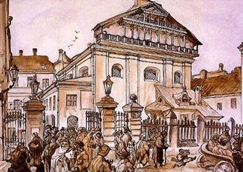
As Soviet Lithuania disappeared, and the new Republic of Lithuania was established, the small remaining Jewish community reorganised itself and looked for ways to give proper memory to the huge community that once formed 40 percent of the population of Vilnius. In 1989 an international competition for the establishment of the Great Synagogue Memorial was held by the Ministry of Culture of the Republic of Lithuania and the Vilnius City Municipality. Amongst the leading tenders was a proposal by architect Tsila Zak from Israel to establish a memorial designed to integrate remains of the original monument recovered through excavation, together with the reconstruction of representative parts of the original complex supplemented with symbolic architecture.
As part of the planning procedure a preliminary excavation was organised to localise the remains of the Great Synagogue and to judge their potential.
The excavation, led by Zenonas Baubonis and Mindaugas Mačiulis of the Kultūros paveldo išsaugojimo pajėgos (‘Cultural heritage preservation forces’), was initiated by the Cultural Heritage Department of the Ministry of Culture, with the objective of identifying and localising the remains of the Great Synagogue of Vilnius, and assessing the nature, scope, methodology and research goals for the future.
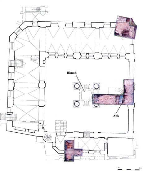
In order to identify the exact location of the Great Synagogue of Vilnius it was necessary to collate historical plans and maps and then link them into the cartographic database of the Lithuanian State Coordinate System.
The area selected for archaeological prospection was dictated by the cartographic knowledge base together with the necessity to avoid modern buildings and infrastructure, roads and vegetation, and the desire to excavate significant parts of the building required for planning any future memorial at the site.
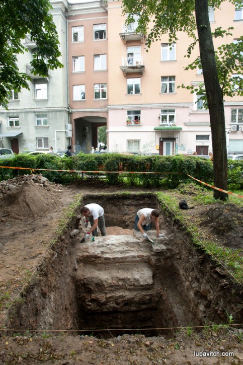
During the summer of 2011, archaeologist Zenonas Baubonis started the excavation and decided to concentrate on three soundings, totalling 79 square metres:
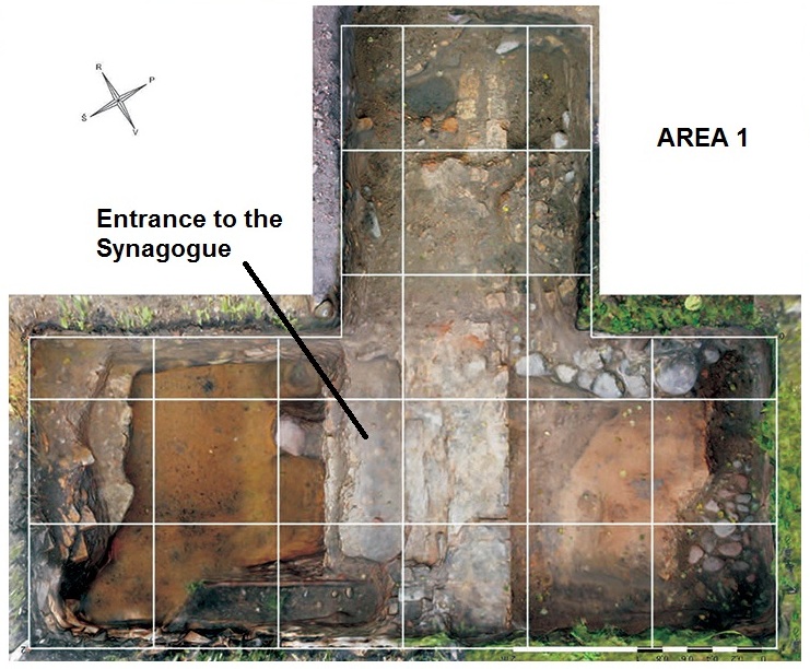
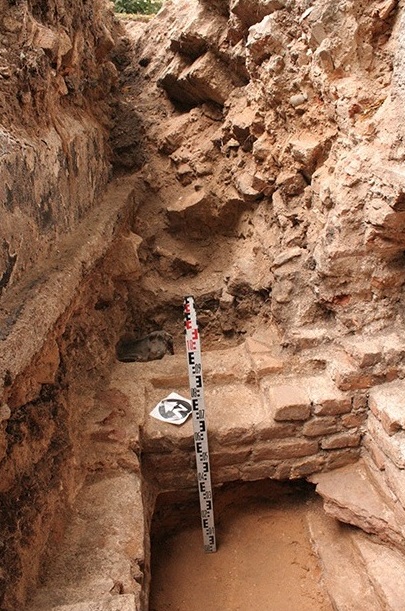
1 – the entrance to the Great Synagogue of Vilnius from the Shulhoyf. The excavation exposed part of the synagogue extension (the polish); the southern wall, constructed from bricks and up to 1.8 metres wide; the entrance to the synagogue from the Shulhoyf; and three steps leading down from the entrance to a paved surface. Based on the excavation and historical sources, this part of the site dates to the second half of the 18th century, including reconstructed sections from the renovation of the synagogue in 1873. In the fill were glazed pottery shards and decorated paper sheets dating the fill to before the 18th century.
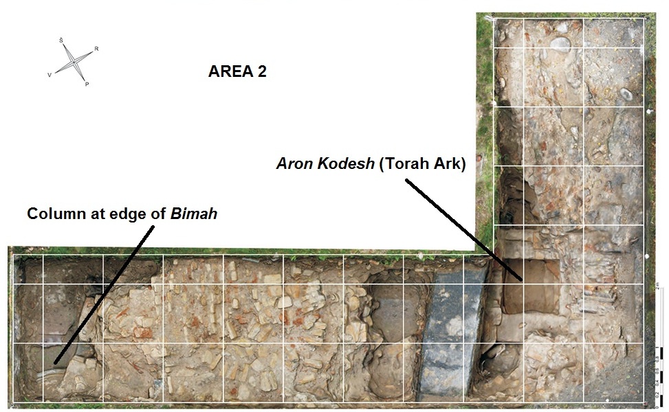
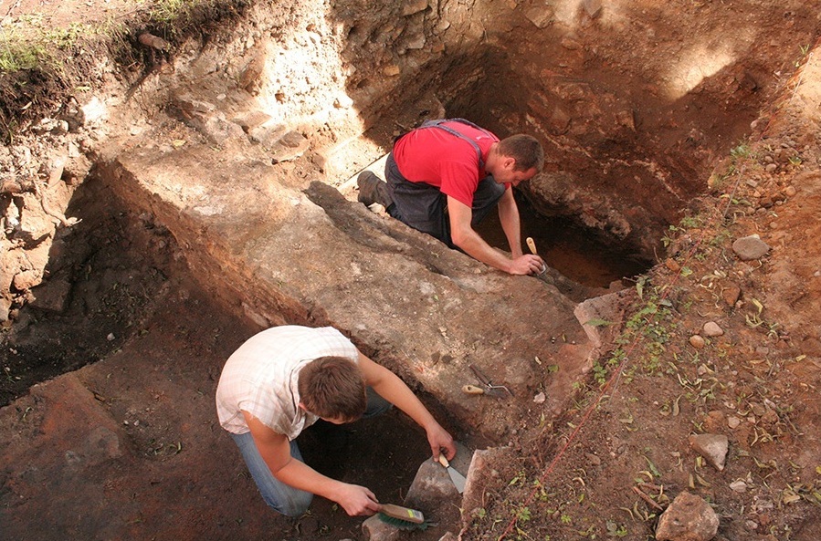
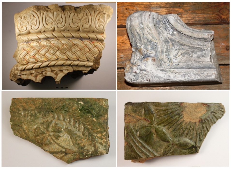
2 – the site of the Bimah and Aron Kodesh. Much of the area was filled with the remains of a brick vault that had crashed down on the floor from the roof of the building. The excavation unveiled the eastern wall of the Great Synagogue built of bricks bonded with lime mortar. Within the wall was a niche, measuring 160 × 110 cm, that is probably set below the Aron Kodesh. This niche most likely dates to the 17th century, from the time of the first construction of the synagogue. At the opposite side of the sounding was the column base of the Bimah, with a diameter of 57 cm and a surviving height of 40 cm. Adjacent to the base were fragments of a terrazzo floor. The floor was indeed two metres below street level, as noted in the written sources. This led up to the base of the banister wall leading up to the Bimah from the time of the 1893 reconstruction. Finds from this sounding included coins dated to 1664 of the Grand Duke John II Casimir Vasa, minted both in Vilnius and in Poland; a coin from 1880 of Tsar Alexander III; decorative cornice tiles; and floor tiles.
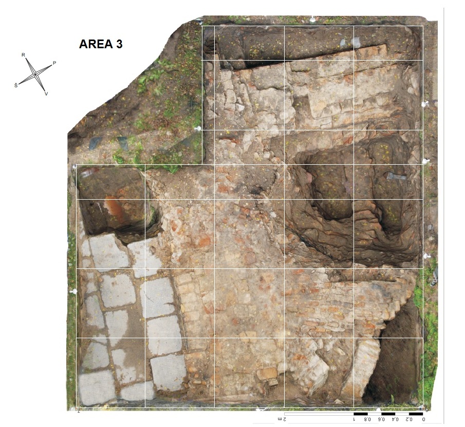
3 – the north-eastern corner of the Great Synagogue. The walls have a width of 150 to 250 cm. Finds from this area included a Polish coin of Stanislaus Augustus dated 1788 and a Nazi 10 pfennig coin; tile fragments; pieces of a sculpted cornice; glazed pottery fragments and brass decorative ornaments from a book. These latter items date between the 17th and 19th centuries.
To preserve the remains of the Great Synagogue after the excavation, the remnants were covered with geotextile, backfilled with clean soil and resown with grass, until such time as the remains can be exhibited in the future as a proper commemoration of the Great Synagogue, the Shulhoyf and the Jewish Quarter of Vilnius.
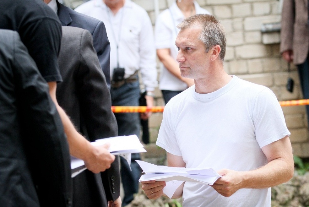
The excavation led by Zenonas Baubonis in 2011 was the source of much interest both from the Lithuanian authorities and the small surviving Jewish community in Vilnius. Visitors to the site included the Lithuanian Prime Minister, Andrius Kubilius, who stated that the Great Synagogue and the excavations “are important not only for Lithuania, but for the global Jewish community. It is a powerful symbol of both a great Jewish heritage, a great tragedy when the entire Jewish community was destroyed, and it is a very powerful symbol for the Jewish future. … Litvak cultural heritage is extremely important and we should be proud of what was created here by the Jewish community. … The Great Synagogue is not only about Jewish history, it is a particularly important element in Lithuania’s history of the colourful and multiethnic Vilnius”.
Excavation Scenes, 2011
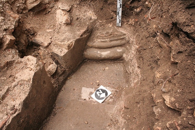
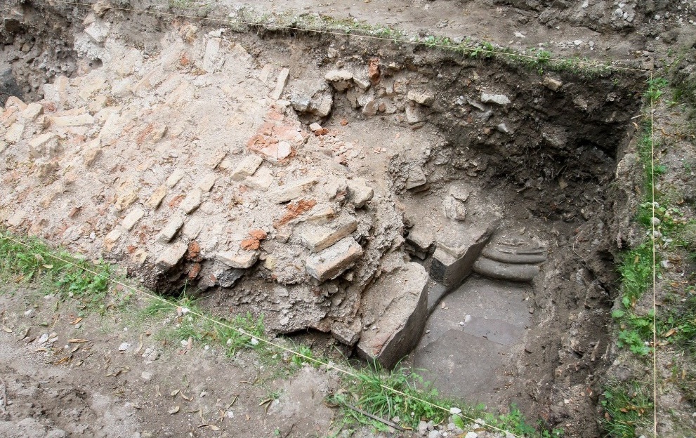
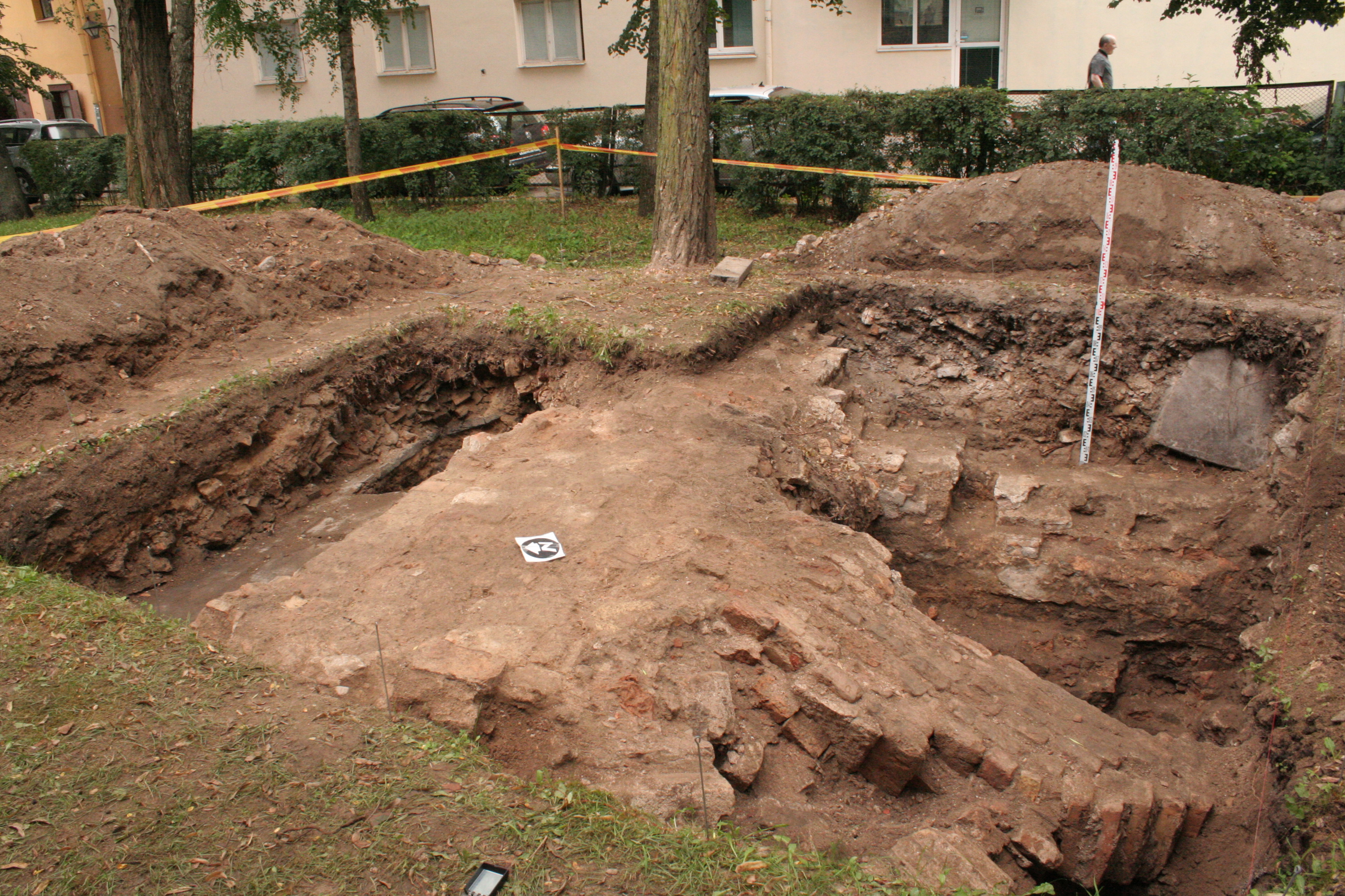
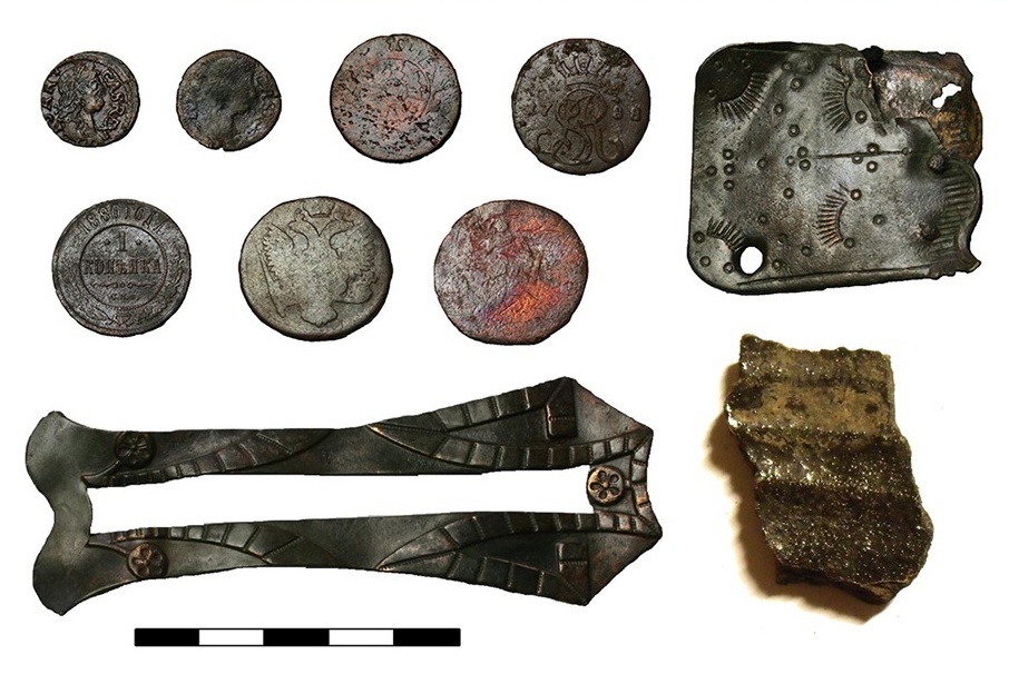
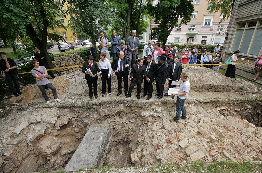
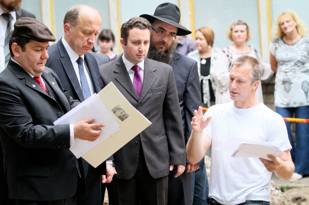
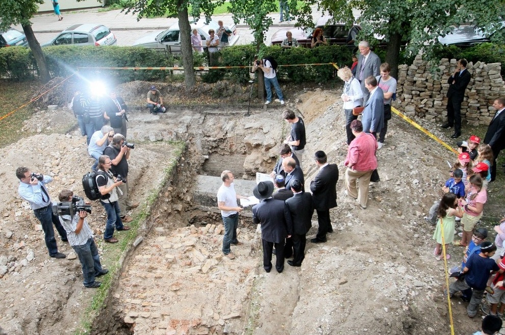
In 2013 Dr. Jon Seligman visited the site, together with his father, David Seligman, as part of a ‘Roots’ visit to Lithuania, the historical Heim of the Seligman family. During this visit he initiated a joint project at the site of the Great Synagogue with the aim of intensifying the excavations through the involvement of an international consortium of heritage professionals. To get the project moving, the first stage was identifying the potential of the site. Prof. Richard Freund, Prof. Harry Jol and Dean Phillip Reeder joined together with the team, bringing their geophysical expertise to assess the potential of the site.
The 2015 Ground Penetrating Radar (GPR) Survey
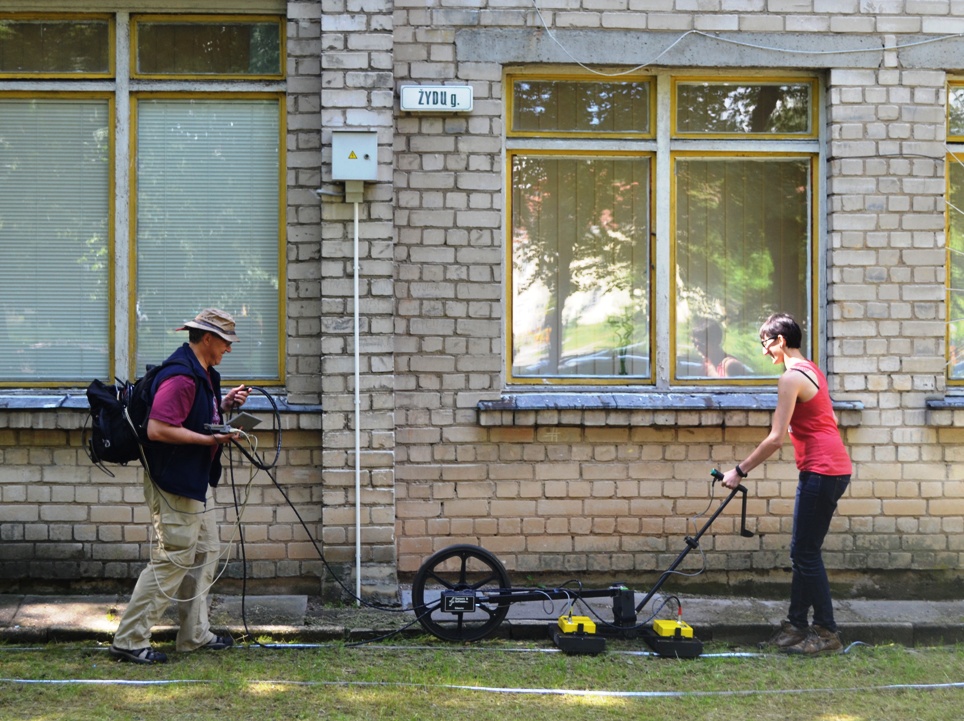
In June 2015 the first season of project work was conducted at the site of the Great Synagogue and Shulhoyf of Vilna (Vilnius). This season of work was devoted to a Ground Penetrating Radar (GPR) survey of the site, to gauge the exact positioning of the underground remains and to better understand the archaeological potential of the site prior to the future investment of further resources to fully uncover the remains through excavation.
This season of work was sponsored by members of the team itself, aided by a generous grant from the Commission for the Preservation of America’s Heritage Abroad of the US State Department. Commissioner Dr. Joan Silber not only helped the project through the provision of a grant, but also personally documented its progress with photographs and video.
What is Ground Penetrating Radar?
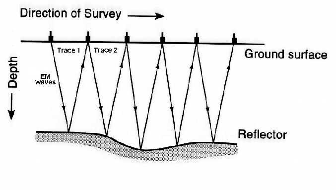
Ground Penetrating Radar (GPR) is a tool that allows archaeologists and geoscientists to work together to map an area that they think might yield important finds and explore the subsurface without disturbing the site. This non-invasive, non-destructive survey allows the researcher to assess and prioritise future work that could be explored through more invasive means: coring, sampling, small archaeological probes and long-term excavation. Based on the data collected, GPS locations can be pinpointed on the site maps so that future excavations can be extremely precise and planned with great care, especially in areas where there are identified artefacts of singular importance. This methodology can save money, time and human resources in modern archaeological digs, but it also ensures that an excavation is planned with attention to the priorities of exigency (salvage) and, where possible human remains are located, that provisions are made in advance.
Before GPR, archaeologists would excavate with little knowledge of what they might find below the surface. The GPR system works by sending high-frequency electromagnetic waves (similar to FM radio signals) into the subsurface through an antenna. These waves reflect back off changes in the materials and layers below the surface and are received by a second antenna. As the data is collected in the field and stored on a computer, an image of the soils underneath can be seen. With the data stored, post-processing after leaving the site can extract details of the structure of the subsurface through 2D and 3D visualisations. These 2D and 3D images or maps of the subsurface contain various patterns that are interpreted.
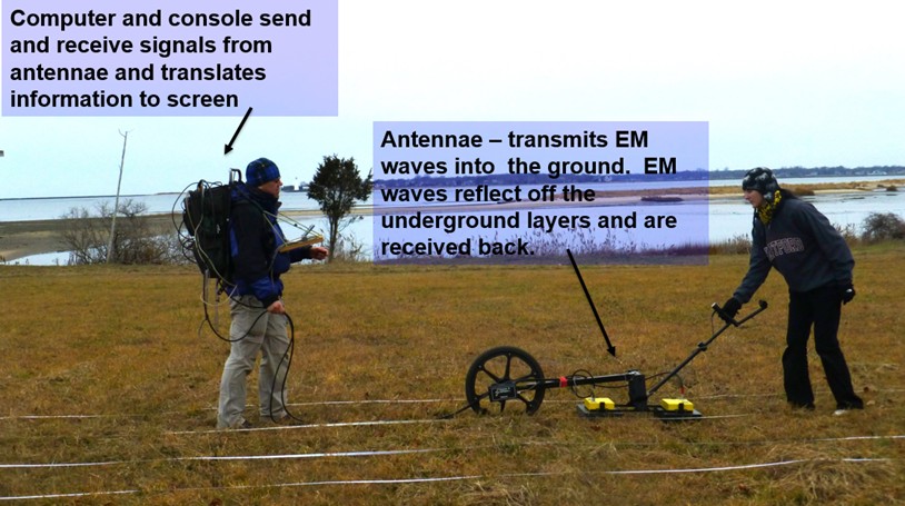
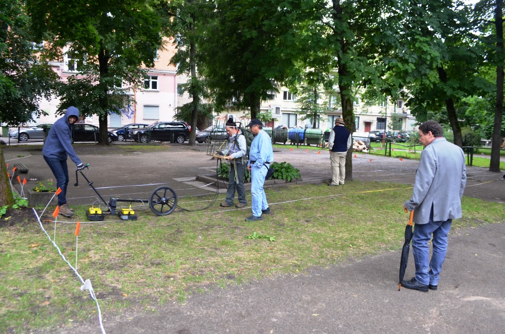
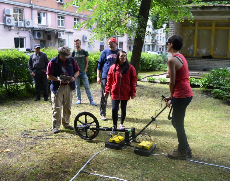
For the GPR survey of the Great Synagogue of Vilna, Professor Harry Jol of the University of Wisconsin at Eau Claire used a pulseEKKO 1000 GPR system and 225 MHz antennae. The backpack carries the console and computer to allow for portability while a second person pulls the antennae along the ground surface, the wheel triggering the system to send electromagnetic (radio) signals into the subsurface. After the waves have been returned, the computer receives the echo in real time, compiles the data and displays it on the screen. By looking at the readings one can detect anomalies beneath the surface. Based on the clustering of these anomalies, a higher-resolution survey with a tighter grid and 450 MHz antennae can be used to collate more detailed data.
The raw data was transferred to Dr. Dean Goodman, a geophysicist of GPR-SLICE Software and the Geophysical Archaeometry Laboratory in California, USA, who processed the data with 2D/3D time slices, isosurface and overlay analysis and provided 3D models and animations. The time slices can be used to help determine the areas most likely to yield useful excavations.
Previously Prof. Jol, together with Prof. Richard Freund and Prof. Philip Reeder, conducted similar research at other sites with potential for gathering data from a GPR survey in an archaeological context. Data sets collated and analysed with GPR technology were used to pinpoint locations at archaeological sites for further research and excavation, so that not all of the areas have to be disturbed. A three-dimensional survey in Nazareth at the Church of the Annunciation (Greek Orthodox) in Israel provided data on an ancient church at the site. Similarly in Rhodes, Greece, a survey of the 16th-century Kahal Gadol Synagogue, also destroyed by the Nazis in World War II, will enable the local archaeological authorities to consider excavation and restoration with full knowledge of the subsurface and of earlier iterations of the synagogue built on the same spot. Other work includes a GPR survey of the extermination camp at Sobibor in Poland, where the survey was used to better understand the layout of the camp that was dismantled in 1943.
The GPR Survey at the Great Synagogue of Vilna (Vilnius), 2015
The Great Synagogue of Vilnius (Vilna) is an excellent target because the GPR system works well when a well-defined area can be worked on and plotted on an existing footprint, guided by the research questions stated at the outset and the physical constraints dictated by the site.
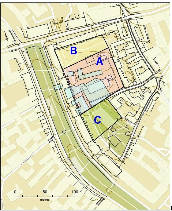
It is proposed to cover three separate areas of the site. In 2015 the GPR survey was concentrated on the immediate area of the destroyed synagogue (Area A), the aim being to identify the building of the synagogue and of the Shulhoyf. Particular attention was given to isolating the remains of the ritual bath (miqveh) and the water system, as there is a strong possibility that these areas of the site are better preserved, as they were set below the original floor levels. The other areas to be surveyed with GPR in coming seasons are Area B to the north of the synagogue complex and Area C to the south, the aim being to outline the structures of the immediate area of the synagogue and to connect the complex with the surrounding urban fabric.
- Area A (pink overlay): the area above the structures of the Great Synagogue and the surrounding courtyards and buildings – 5,700 square metres (excluding the standing school building).
- Area B (yellow overlay): the area to the north of the Great Synagogue – 2,400 square metres.
- Area C (green overlay): the area south of the Great Synagogue, the Ramayles Yeshiva and the original Žydų gatvė – 2,000 square metres.
- The structures of the Great Synagogue and the surrounding buildings are marked in blue.
The goal of the first season of the GPR survey was to gauge the exact location of the underground remains and to better understand the archaeological potential of the site prior to the future investment of further resources to fully uncover the remains through excavation. With only five days available, it was decided to concentrate on Area A, covering a major portion of the synagogue and Shulhoyf.
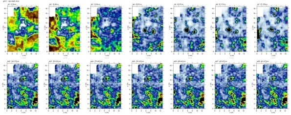
The first area surveyed was the space west of the school building, up to the line of trees along Žydų Street. To provide a control, two grids were set up connecting to the known results of the 2011 excavation conducted by Zenonas Baubonis. Initial results indicated a clear match between the 2011 excavation, the plan of the synagogue and the GPR survey results. Especially clear in the scans were the interior and exterior walls, the Bimah and the Aron Kodesh (Torah Ark).
The second area surveyed in 2015 was east of the school building, covering areas that, according to the plan of the Shulhoyf, should include the miqveh complex, the Old Kloyz, the Yesod Kloyz and the back section of the Great Synagogue. Initial impressions were positive, including what may well be the miqveh and the synagogue walls. The importance of this result cannot be underestimated, and it governed our decisions concerning where to excavate in the following seasons.
Scenes of the 2015 GPR survey at the site of the Great Synagogue and Shulhoyf of Vilna